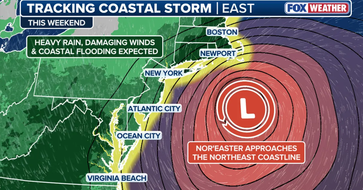
Residents across the New York City metropolitan area and New Jersey are being advised to prepare for a significant shift in weather patterns as the first major nor’easter of the 2026 fall season approaches. Meteorologists are tracking a powerful low-pressure system currently developing along the East Coast, which is expected to bring a combination of heavy precipitation, intense wind gusts, and dangerous coastal conditions to the Tri-State region. While the early part of the week will see the initial build-up of the system, the most severe impacts are currently forecasted to arrive over the weekend.
What happened
The weather outlook for the coming days indicates a multi-stage arrival of the storm. Beginning Tuesday and continuing through Thursday, the region will experience a precursor to the main event, characterized by windier conditions and afternoon highs settling in the mid-60s. By Friday, the low-pressure system is expected to begin its push northward, with southern New Jersey likely seeing the first signs of deteriorating weather.
The core of the storm is projected to intensify significantly as it nears the New York and Long Island coastlines on Saturday and Sunday. Current projections suggest that if the storm maintains a track closer to the coast rather than heading out toward New England, New York City could face wind gusts ranging from 60 to 70 mph. Rainfall totals are also a major concern; eastern Long Island is currently braced for upwards of three inches of rain, though these figures could increase if the storm shifts further inland.
Beyond the wind and rain, the system is expected to be a long-duration event for coastal communities. Unlike fast-moving storms, this nor’easter will likely stall or move slowly, leading to several days of rough surf, significant beach erosion, and the threat of flooding in low-lying areas during high tide cycles.
Context
A common misconception regarding nor’easters is that they must involve snow or freezing temperatures. However, meteorologically speaking, a nor’easter is defined by the direction of the wind rather than the type of precipitation. The name is derived from the winds that blow from the northeast off the Atlantic Ocean as a result of a strong low-pressure system. This means that even with temperatures in the 50s or 60s, a system can be classified as a nor’easter if the wind profile meets the criteria.
These storms are most frequent between September and April, a period when the jet stream becomes more active and the temperature contrast between the cold air over the land and the warm waters of the Atlantic is most pronounced. This temperature gradient provides the fuel necessary for these systems to “bomb out,” or rapidly intensify, as they move along the coastline. In the case of this 2026 storm, the timing aligns with the peak of the autumn transition, where the atmosphere is particularly volatile.
Why it matters
The importance of this storm lies in its potential for structural and environmental damage. Coastal flooding is a primary concern, as astronomical tides combined with persistent onshore winds can prevent water from receding between tide cycles. This often leads to significant damage to dunes and coastal infrastructure in areas like Queens and eastern Long Island.
Furthermore, the “track” of the storm is the most critical variable for urban centers. A shift of just 50 miles can be the difference between a standard rainy weekend and a major weather emergency featuring power outages and transit disruptions. For New York City, a more westerly track puts the five boroughs directly in the path of the strongest winds and heaviest rain. Local authorities are urging residents to secure outdoor furniture, check basement sump pumps, and stay informed on forecast updates as the system’s final path becomes clearer toward the end of the workweek.